


Voting District 0303, Cochran County, Texas
About
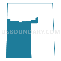
Outline

Summary
| Unique Area Identifier | 671499 |
| Name | Voting District 0303 |
| County | Cochran County |
| State | Texas |
| Area (square miles) | 279.00 |
| Land Area (square miles) | 279.00 |
| Water Area (square miles) | 0.00 |
| % of Land Area | 100.00 |
| % of Water Area | 0.00 |
| Latitude of the Internal Point | 33.53882610 |
| Longtitude of the Internal Point | -102.93430990 |
Maps


Graphs
Select a template below for downloading or customizing gragh for Voting District 0303, Cochran County, Texas


Neighbors
Neighoring Voting District (by Name) Neighboring Voting District on the Map
- Voting District 0101, Cochran County, TX
- Voting District 0202, Cochran County, TX
- Voting District 0205, Cochran County, TX
- Voting District 0303, Yoakum County, TX
- Voting District 0306, Cochran County, TX
- Voting District 0404, Yoakum County, TX
- Voting District 0404, Cochran County, TX
- Lea County Precinct 3, Lea County, NM
- Roosevelt County Precinct 3, Roosevelt County, NM
- Roosevelt County Precinct 4, Roosevelt County, NM
Top 10 Neighboring County Subdivision (by Population) Neighboring County Subdivision on the Map
- Morton CCD, Cochran County, TX (2,450)
- Plains CCD, Yoakum County, TX (2,025)
- Dora CCD, Roosevelt County, NM (1,721)
- Tatum CCD, Lea County, NM (1,403)
- Whiteface CCD, Cochran County, TX (677)
Top 10 Neighboring Place (by Population) Neighboring Place on the Map
Top 10 Neighboring Unified School District (by Population) Neighboring Unified School District on the Map
- Morton Independent School District, TX (2,280)
- Plains Independent School District, TX (2,033)
- Tatum Municipal Schools, NM (1,465)
- Whiteface Consolidated Independent School District, TX (932)
- Dora Consolidated Schools, NM (648)
Top 10 Neighboring State Legislative District Lower Chamber (by Population) Neighboring State Legislative District Lower Chamber on the Map
- State House District 83, TX (173,230)
- State House District 62, NM (30,322)
- State House District 66, NM (29,720)
Top 10 Neighboring State Legislative District Upper Chamber (by Population) Neighboring State Legislative District Upper Chamber on the Map
Top 10 Neighboring 111th Congressional District (by Population) Neighboring 111th Congressional District on the Map
- Congressional District 19, TX (698,137)
- Congressional District 3, NM (693,284)
- Congressional District 2, NM (663,956)
Top 10 Neighboring Census Tract (by Population) Neighboring Census Tract on the Map
- Census Tract 11, Lea County, NM (4,557)
- Census Tract 4.02, Roosevelt County, NM (3,690)
- Census Tract 9501, Cochran County, TX (3,127)
- Census Tract 9501, Yoakum County, TX (2,025)